
February 5, 2013
Tom Mahood spent nearly all of last year in New Mexico, so I had a slight respite from joining him on his crazed hikes searching for Bill Ewasko (see posts elsewhere on this blog), but as his time there was waning in late summer, I started getting “I have ideas” emails and he started refering to the coming cooler months as “Ewasko Season.” Desperate to distract him, I came up with the idea of searching for some of the odder things associated with Cary’s Castle. He bit, but merely added it to the hiking agenda. Instead of replacing Ewasko hikes, this was to be in addition to.
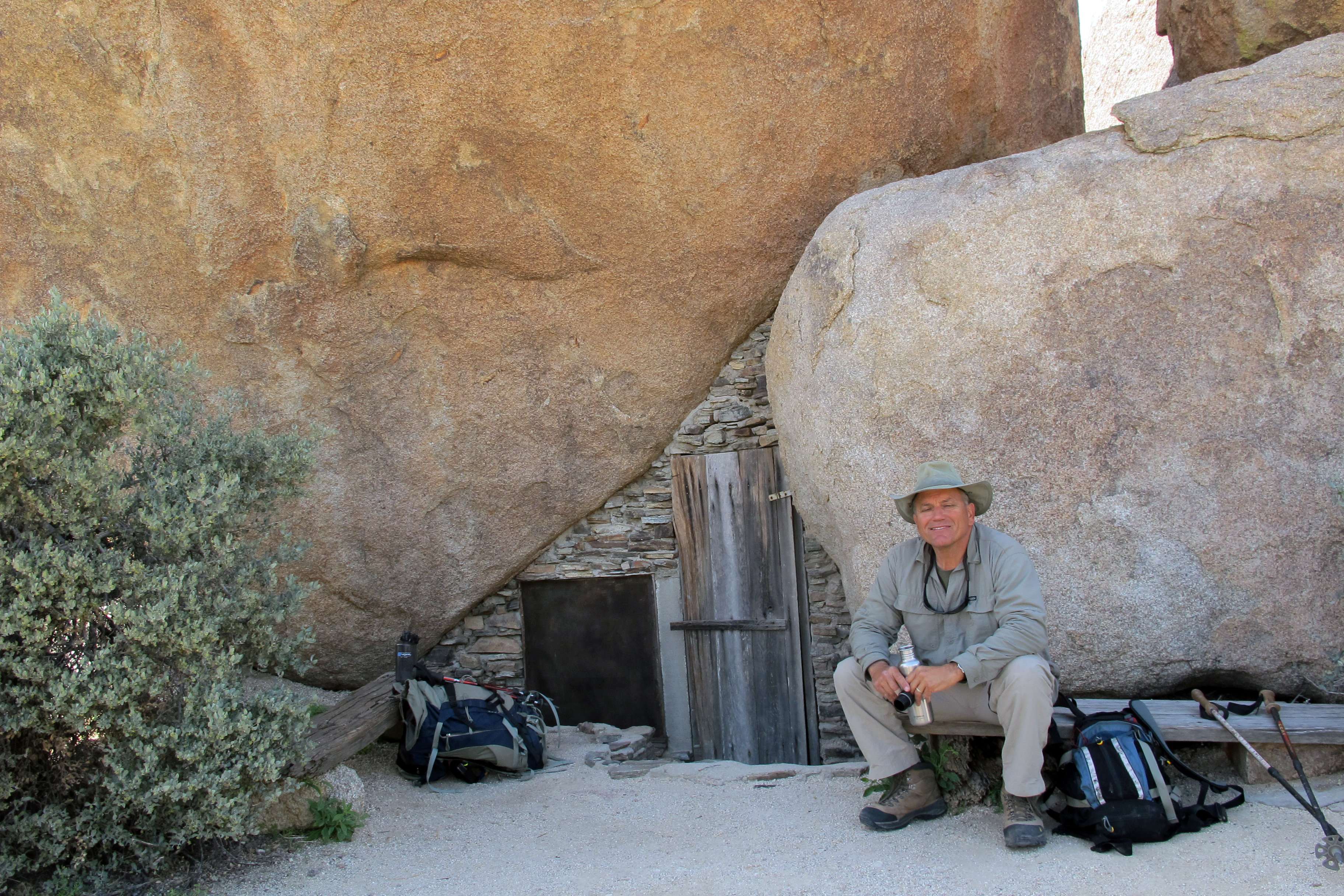
Cary’s is a very cool little place way out on the eastern edge of Joshua Tree. Essentially an old Native American “cave,” this had been slightly walled in and turned into a miner’s one-room abode. Still present are the remains of bed spring, stovepipe, shelf, and a few knickknacks. There is a mineshaft nearby, but rumor also existed of other interesting things to find.
The site was inhabited around 1940, but virtually disappeared for decades and was known only to very few. Even in Patty Furbush’s 2005 edition of On Foot in Joshua Tree National Park, the Castle was mentioned as a sensitive site and she never gave its location. Lately, however, even the USGS topos show its location.
My first trip out there was in early 2012 with Lew Kingman. We took the requisite shots sitting in front of the castle, explored the inside without disturbing anything, looked around a little and left. Eight miles round trip and the alluvial fan at the bottom portion of the hike was alive with spring wildflowers. A great spring hike in the desert.
The next trip out there was with Tom Mahood and Pete Carson in November. We found what we believe to be “Lost Indian Tank,” a tiny man-made dam likely dating from the cattle days in the what is now Joshua Tree, and mentioned in Linda Greene’s 1983 Historical Resources Study of JT. We followed some of the old roads in the area, but didn’t turn up much.
After some very nice research by Tom, we now knew that Arthur Lloyd Cary had staked out the Welcome Stranger Mine in 1938 and we had a good idea of where the rock cairns marking the claim’s corners should be. A couple more trips out, dragging Paul Caraher along on one, and we had found pretty much everything we had been looking for, including the rock cairns.
One of these hikes involved Tom’s “Alternate Route” out, which was a canyon east of the main one used as a trail. It was sporty. Tom won’t be naming anything “Alternate Route” again if he’s wise. Another trip used an exit strategy involving a canyon to the west of the main trail. The latter was steep, rocky, and choked with more cholla than I’d ever seen. As we were turning sideways to squeeze past them, Tom cautioned me to speak softly, lest we wake them. I laughed, but didn’t speak. I wasn’t taking any chances.
Cary’s is truly a cool site involving mining history, Native American history, and cattle history. I’ve now hiked about 50 miles total getting there and back, though, so I’m pretty much done with Cary’s Castle.
One note: With the site now listed on the USGS topos, the secret of Cary’s is out. Just in photos on the Internet, you can see damage done and items missing in the last 5-6 years. Please do your best to treat the site kindly if you visit. If you venture out there, take away only pictures and disturb nothing. If you camp there, camp well away from the Castle or anything else of cultural significance. Better yet, don’t camp. It’s only an 8-mile hike and there is no water out there for camping in any case.


